 Regarding animals and the weather, I'd have to say Sam Gribley's nuthatch would have been a good forecaster. Here, the score is:
goldfinches...1
weatherman...0
The weather report said it was to be sunny and warmer with a fifty percent chance of precipitation. The goldfinches said it was time to eat as much as possible before the weather turned.
We ended up with only light flurries, but by early afternoon, the sky looked ominous and the wind brought a dip in temperatures. Back in the 20s for us! Wind chill is now below zero.
So, fight off the chill and take the goldfinch's advice. Actually, take a trip to Hawaii and enjoy this week's carnival of homeschooling.
One useful post I found is some resources for teaching geography. We do map studies with everything. This involves printing up a blackline master and marking physical features according to the color key in our map maker's kit. Mouse then locates the capital and other important cities. As we progress through our reading, she plots new places on the map. Of course, our current map is of Virginia since we are studying Jamestown.
The focus is primarily on topographical and political maps, but we look at others as well. Since we are also studying geology, we have looked at numerous geologic maps. Mouse is learning about contour maps, and has looked at an interesting sort of geologic map that neither of us can make much of. But they are important for geologists, particularly those searching for oil. Which is probably why the first example that popped up on the search was from Haliburton.
 And here is another interesting program for anyone interested in studying geography. I haven't figured it all out yet, and mostly it is just eerie. Google Earth provides you with a 3-D view of the world through satellite images. If microchips and the ability to track every moves bothers you, this will too. We located our house and were able to recognize our car sitting in the drive. My husband showed the kids his old elementary school and we took a look at the Eiffel Tower.
I can't imagine how much more detail is available to the government if this is a free download. OK, maybe I can. Back in the 80s, there was a picture in one of the major news magazines which featured a man lying in a park. You could see the time on his watch as he napped in the sun. Nice satellite photo. And that was a long time ago, in technological terms. No wonder the US is concerned about China's ability to shoot down satellites. Military applications aside, do you have any idea how dependent we are on satellites?
Without them, we'd have to watch the birds to see what the weather had in store for us.
Photo credits:
infrared weather map from NOAA
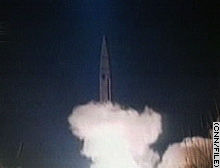
rocket photo from CNN
Related Tags: geography, satellite, weather, birding, maps
We ended up with only light flurries, but by early afternoon, the sky looked ominous and the wind brought a dip in temperatures. Back in the 20s for us! Wind chill is now below zero.
So, fight off the chill and take the goldfinch's advice. Actually, take a trip to Hawaii and enjoy this week's carnival of homeschooling.
One useful post I found is some resources for teaching geography. We do map studies with everything. This involves printing up a blackline master and marking physical features according to the color key in our map maker's kit. Mouse then locates the capital and other important cities. As we progress through our reading, she plots new places on the map. Of course, our current map is of Virginia since we are studying Jamestown.
The focus is primarily on topographical and political maps, but we look at others as well. Since we are also studying geology, we have looked at numerous geologic maps. Mouse is learning about contour maps, and has looked at an interesting sort of geologic map that neither of us can make much of. But they are important for geologists, particularly those searching for oil. Which is probably why the first example that popped up on the search was from Haliburton.
And here is another interesting program for anyone interested in studying geography. I haven't figured it all out yet, and mostly it is just eerie. Google Earth provides you with a 3-D view of the world through satellite images. If microchips and the ability to track every moves bothers you, this will too. We located our house and were able to recognize our car sitting in the drive. My husband showed the kids his old elementary school and we took a look at the Eiffel Tower.I can't imagine how much more detail is available to the government if this is a free download. OK, maybe I can. Back in the 80s, there was a picture in one of the major news magazines which featured a man lying in a park. You could see the time on his watch as he napped in the sun. Nice satellite photo. And that was a long time ago, in technological terms. No wonder the US is concerned about China's ability to shoot down satellites. Military applications aside, do you have any idea how dependent we are on satellites?
Without them, we'd have to watch the birds to see what the weather had in store for us.
Photo credits:
infrared weather map from NOAA
rocket photo from CNN
Related Tags: geography, satellite, weather, birding, maps
